DARE’S HILL CIRCUIT TOUR
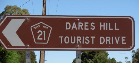
TOURIST DRIVE 21
Hallett to Terowie via Dare’s Hill
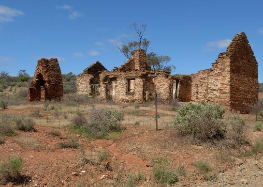
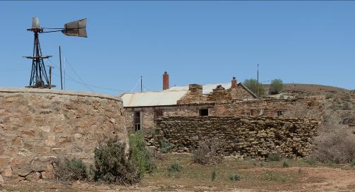
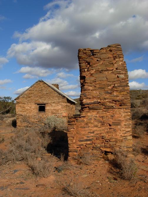
The ruins of Dare’s Homestead, Piltimitiappa.
2009
© The Burra History Group Inc.
2009
1
DARE’S HILL CIRCUIT DRIVING TOUR
Hallett to Terowie via Dare’s Hill
Tourist Drive 21
Introduction
The Dare’s Hill Circuit Drive is a day excursion from Burra that takes in a variety of different outback vistas providing an insight into rural life in the Mid North.
The total road distance covered on this tourist drive from Burra and back, is 165km, 62 kilometres of which, is on the Barrier Highway between Terowie and Burra. Fuel is available on the return trip in Terowie, White Yarcowie, Hallett and Mt. Bryan. However, the drive which is mainly on unsealed roads between Mount Bryan and Terowie will take you onto sheep stations that have become the heart of this rural district. There are no facilities for petrol and other supplies and no mobile phone coverage on this section of the drive a distance of approximately 100kms. Whilst the route can be negotiated in a conventional vehicle, because of the steep hills and creek crossings, it is not advisable to attempt the journey whilst towing a caravan or in a vehicle with inadequate ground clearance. Caution is also advised after heavy rains. Take food, drinking water and suitable clothing for the journey. Allow a minimum of 5 hours to complete the circuit.
The route will take you to the following points of interest;
The Razorback Range
Mount Bryan
The historic Hubert Wilkins Homestead
Mt. Bryan East Historic Site
Dare’s Hill Summit
Piltimittiappa Homestead Ruins
Collinsville Sheep Station
The Old Town of Mallett
Ketchowla Hill (Mt. Dutton)
Ketchowla Sheep Station
Pandappa Conservation Park
Womma Range
Franklyn
Terowie
White Yarcowie
Hallett
Mt. Bryan
Total Route 165 kilometres
Unsealed Road 100 kilometres
Time Required allow 5 hours
Vehicles Adequate ground clearance
No caravans or heavy trailers
2
DARE’S HILL CIRCUIT DRIVING TOUR
Hallett to Terowie via Dare’s Hill
Tourist Drive 21
The distances shown are in kilometres progressively from the Hallett Post Office
Grid References are shown below
3
| 0.0 km S33 24.767 E138 53.499 | Hallett Post Office (Barrier Highway A32) Reset your trip meter to zero. Turn Right off of the main street at the Dare’s Hill Tourist Drive 21 sign alongside of the old Post Office. |
|---|---|
| S33 24.773 E138 53.692 | At East Terrace turn left at the Tourist Drive 21 sign. |
| 0.6 | View the hills ahead (to the north) which are Ulooloo Hill and Mt. Scrub; Mt. Bryan is highest point to the right (east). |
| 2.5 | Pianoleche Homestead on the left |
| 3.3 S33 23.176 E138 54.018 | Road Junction; turn hard right as indicated by the Tourist Drive 21 sign. Heading along Mt. Bryan East Rd. as indicated to Tooralie Homestead. Commence a gradual climb of the slopes which are the beginnings of the range of hills dominated by Mount Bryan. Mount Bryan is seen ahead. |
| 6.2 | Among the hills, where there is still native vegetation, the drier climate east of the Barrier Highway is reflected in the mallee scrub in this area. |
| 8.1 | Here the road travels part-way up a hillside, giving spectacular views out on the left of Ulooloo Hill and Mt. Scrub. |
| S33 22.804 E138 57.424 | Gateway to Banbury Station on the right. Note the Statton Gate built by the famous blacksmith in Hallett. |
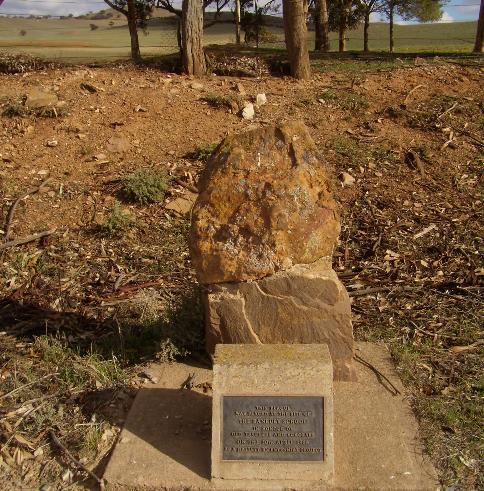
| 10.4 S33 22.896 E138 57.917 | Banbury School: A cairn on the right marks the site of the old Banbury School. |
| 12.1 | Peppermint Gully; stands of Peppermint box are seen along this gully. |
| 12.7 | Bear right on the major road to see Peppermint mallee forming a dense woodland. This woodland is home to parrots, rosellas, cockatoos and other bird life. |
| 14.0 | Emerging from a gully the woodland immediately becomes open grassland |
| 15.5 | A good view of Mt. Bryan can be seen on the right. |
4
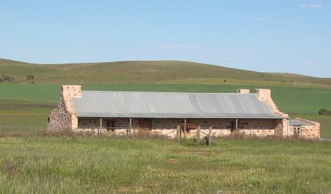
The restored Wilkins Homestead, birthplace of Sir Hubert Wilkins photographer, adventurer, aviator and Polar explorer
5
| 16.2km S33 24.112 E139 00.720 | At this T-junction, turn left and follow the ‘Wilkins Homestead’ signs for 3.3km to see the restored Wilkins Homestead. |
|---|---|
| 19.5km S33 22.607 E139 01.481 | Wilkins Homestead This is the Wilkins family homestead that was in ruins until its restoration in 2001. ‘George Hubert Wilkins was born at Mt. Bryan East, the youngest of 13 children. He went to the local school; then continued his studies at the School of Mines in Adelaide, studying electrical engineering. He when to England in 1909, where he became interested in aviation and spent three years with an Arctic expedition as a photographer. In 1916, he joined the ‘Great War’; following the war he took part in the famous England to Australia air race which won fame for Charles Kingford –Smith. Unfortunately Hubert Wilkins crashed his plane ‘Kangaroo’ at Crete and was unable to complete the race. In 1927 he made several unsuccessful attempts to fly over the Arctic and was stranded on an ice-pack, having to walk for 13 days to reach habitation. Later his mission was successful and he made several flights over the Arctic, receiving a knighthood for his work.’ From a regional history, ‘Razorback Range Country’. A long-drop toilet is provided at this site. Return the way you came back to the T-junction and continue straight on as indicated by the Tourist Drive 21 sign. |
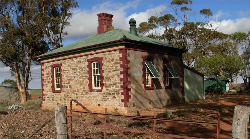
Mt. Bryan East School, now a stopover for hikers.
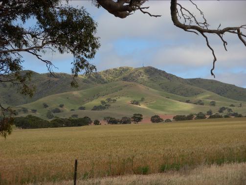
A view of Mt. Bryan the highest point in the Razorback Range
6
The View from Dare’s Hill summit
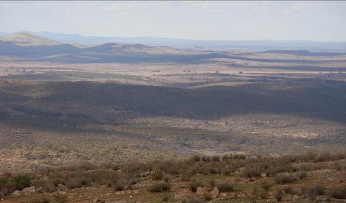
The photograph at the bottom right shows a view looking east
7
| 24.2km S33 24.580 E139 01.034 | Mt. Bryan East: At this T-junction, turn left and pass the site of the little town of Mt. Bryan East (now in ruins). The abandoned buildings on the right were the school and church. The school operated from 1885-1919. Public Toilets are provided behind the Old Mt. Bryan East School. |
|---|---|
| 26.2km S33 24.567 E139 01.892 | Dustholes Creek. This is a major creek crossing on the route. |
| 27.5km | Note the creek to the right of the road with a spectacular erosion chasm. Here the road crosses a creek bed and numerous watercourses flow out of the surrounding hills, explaining the heavy vegetation in this mallee woodland. |
| 28.0 | Goyder’s Line. Crossing Goyder’s Line there is a significant change in the vegetation with multi-stemmed mallee, with the first appearance of saltbush and a little further on Native Pines. George W. Goyder was Surveyor General of South Australia. In 1865, when many pastoral runs were in the grip of a drought, Goyder was sent north to determine which stations would be eligible of drought relief. On his return, Goyder drew the border line dividing the affected areas across a map of the colony, which became known as Goyder’s Line. At the time, Goyder’s blunt claim that everywhere beyond the Line was suitable only for grazing turned into something of a bombshell that dictated Government policy on rural expansion until 1874. The fact is that, considering the sparsely detailed maps with which he worked, it has stood the test of time as a surprisingly accurate delineation of the 10 inch line of rainfall, determined by the very changes in vegetation you see at this point. |
|---|---|
| 31.7 S33 21.935 E139 03.941 | Dare’s Hill Summit The spectacular view from here takes in the Wonna Range ahead from the left, the Chinaman’s Hat Hill ahead, and Ketchowla Hill to the right. The steep and winding descent provides spectacular views over the hills leading into dense woodland below. This is the narrow valley of the Piltimitiappa Creek. |
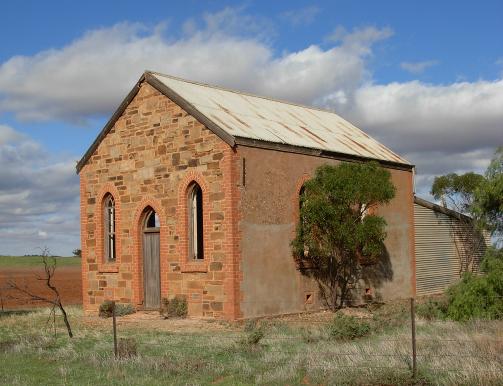
The ruins of the Mt. Bryan East Bible Christian Chapel
8
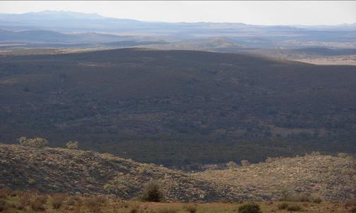
The view looking northeast from Dare’s Hill summit
The change in vegetation looking down into Piltimitiappa Valley is quite striking.
9
| 33.9km | The Piltimitiappa Valley with its tributaries and its mallee woodland dominates this scene at the bottom of the descent. |
|---|---|
| S33 21.587 E139 03.741 | Grid |
| 34.0km S33 21.104 E139 04.624 | Grid: The road enters Collinsville Station as it crosses the grid. Native paintings are found in this area. |
| 37.1km S33 21.230 E139 06.167 | Piltimitiappa Homestead Ruins are seen on the right-hand side of the road. This property was established by William Dare in the 1850s and it was one of the earliest homesteads in the area. See the gravesites, the old windmill and stone tank that are reminders of that early pastoralist’s venture. |
| S33 21.192 E139 06.237 | Piltimitiappa Grave sites. The next 1.6 kilometres of the road pass through an attractive woodland. |
| 38.7km | The road emerges onto open country that exhibits quite different vegetation, predominantly saltbush, dotting the hills. This change is the result of moving from the siltstone region associated with Dustholes Creek to the older slate Tapley Hill formations. |
| 39.7km S33 20.402 E139 07.200 | Grid |
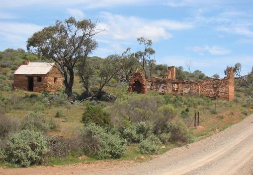
The ruins of William Dare’s homestead beside the Piltimitiappa Creek
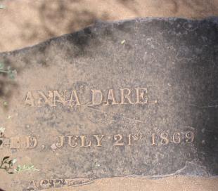
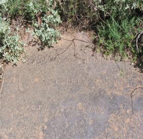
The gravestones of Anna Dare wife of William, died July 1869
and
Marion McKerrow died November 1873.
10
11
| 42.1km S33 19.817 E139 08.343 | The road bears left and commences to climb. Ignore the right fork that goes to Collinsville Homestead. The Collinsville property, which you have been driving through, is world-renowned for its stud rams and excellent wool. At the top of the crest there are long views of the Wonna Range and the following descent takes you to the alluvial plain created by the Wonna Creek, one of the major watercourses in the district. |
|---|---|
| 45.3km S33 18.147 E139 08.220 | Wonna Creek Crossing This crossing is subject to flooding after heavy rain. |
| 45.5km S33 17.997 E139 08.270 | Grid |
| 47.1km S33 17.322 E139 08.363 | Mallett Homestead is on the right and the Mallett Reservoir is ahead to your right. Although this site was surveyed for the township of Mallett, it was never developed. |
| S33 17.246 E139 08.460 | Road Junction (Mallett Rd., Dare’s Hill Summit Rd. and Ketchowla Rd.) At this T-junction, Take the major road to the right and pass the reservoir on your left. |
| 48.6km S33 17.552 E139 09.200 | Gate: Entrance to Ketchowla Station (Leave all gates as you found them) |
| 50.5km S33 17.835 E139 10.083 | Dare’s Windmill on your right and its large old stone tank is one of the historic landmarks of the district. The road climbs slowly from the Wonna Creek plain and then more steeply as it crosses the Tapley Hill formation up onto the open grasslands of the high plateau country. |
| 52.3km S33 17.865 E139 11.177 | Grid Through this grid the road climbs to a saddle between hills revealing Mt. Pullen (Ketchowla Hill) on the left. On the high plateau, an abandoned windmill and stone tank on the left with an unusual natural stone outcrop on the right. Saltbush and bluebush are the predominant vegetation here with a few mallee and sandalwood. A view across the vast eastern plains that stretch to the Murray River and beyond now opens up as the road begins to descend. |
| 54.4km S33 18.223 E139 12.636 | Gate surrounded by saltbush. |
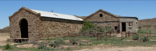
Old Ketchowla shearing shed
12
| 58.4km | Grid: Pulpara can be seen directly ahead. |
|---|---|
| 59.3km S33 17.599 E139 12.968 | Old Ketchowla Homestead and out buildings are on your left. The original Ketchowla head-station was established by Christopher Giles, father of explorers Ernest and Alfred. |
| S33 17.539 E139 12.885 | Ketchowla Shearing Shed |
| S33 17.454 E139 12.983 | Pulpara Road Turnoff Ignore this turnoff to your right and continue straight ahead and veering slightly left past the outbuildings on your left. |
| S33 17.396 E139 12.910 | Ruined windmill with stone tank and out buildings. |
13
| 60.5km | Ketchowla Homestead on the right |
|---|---|
| 61.5km S33 16.623 E139 12.457 | Creek Crossing with concrete ford |
| 62.2km | Grid and old tanks |
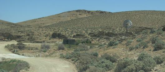
| 62.8km S33 16.292 E139 11.914 | Large Stone Water Tank on right-hand side of the road Creek Crossing with Windmill atop an old well (still in use) feeding water to an old stone water tank. A quarry on left. |
| 63.1km S33 15.601 E139 11.804 | Double Gate. The Wonna Range is in view ahead. The vegetation is now mainly saltbush, bluebush, mallee and sandalwood. Note the remnants of old telephone line. |
| 69.8km S33 12.424 E139 11.120 | Dave’s Hut ruins on the left of the road. Built by David Dearlove of Ketchowla in the 1930s it became a popular stopover for travellers. All that remains now is the well made fireplace and chimney. Bluebush and blackbush are in the surrounding open woodland. S-bends The next stretch of road has a number of S-bends and care should be taken negotiating them. |
| 71.6km S33 12.174 E139 10.803 | Grid at the Ketchowla Station boundary, followed by more S-bends. |
| S33 12.133 E139 10.738 | Pine Creek Turnoff on the right. Marked Faraway Hill Rd. |
| 76.5km | Pandappa Conservation Park is on the left. The Park takes its name from Pandappa Homestead that was settled in 1859 by Peter Waite a successful pastoralist who donated his Urrbrae property and other land to the State resulting in the establishment of the Waite Institute and Urrbrae Agricultural High School. |
| 77.0km S33 11.907 E139 10.179 | Grid with views of the Wonna Range |
| 79.0km | More S-bends The landscape features a mallee plain and the steep hillsides of the Wonna Range. |
14
| 79.7km S33 10.141 E139 08.615 | Pandappa Conservation Park Entrance on the left. You can explore the Pandappa Conservation Park at your leisure. As you leave the Park entrance you will see the remains of an old rabbit-proof fence on the left and the old telegraph line on the right. |
|---|---|
| 83.9km S33 08.621 E139 02.842 | Holder Rd. Turnoff Pass through the Holder Road intersection and continue straight on. |
| 86.1km | Veer left at the Y-junction leaving Franklyn Road to your right. The town of Franklyn was optimistically surveyed in a good season but it was never developed. The homestead and out buildings of Franklyn can be seen on the right. |
| 86.2km | Statton Gate on the left. This leads to an old ruin, on the left. The sturdy steel Statton Gate built at Ned Statton’s Balcksmith shop in Hallett was a stock item in the Mid North and something of a local icon. (Statton’s Blacksmiths 1892-1957) |
| 87.0km | Oppenheimer Telegraph Pole on the right-hand side. These metal poles were more durable than the wooden poles that suffered termite damage. They were used extensively on the Overland Telegraph route. You are now in Whipstick Mallee country |
| 90.4km S33 08.537 E139 00.302 | Top of the Range. Take in the views of the surrounding open country with the township of Terowie in the distance. Note the old telegraph lines on the right. |
15
| 92.2km S33 08.529 E138 59.121 | Deep Creek Road Intersection: Bear left here to head for Terowie. Travelling on this stretch of the road, you encounter ‘modern’ Oppenheimer and old wooden telegraph poles with a view of Stumpy Hill to the left. The Hallett Wind Farm can be seen from here. |
|---|---|
| 95.0km | Saltbush Plantation on the left. Broken windmill and old tank on the right |
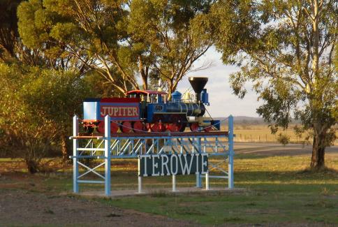
| 98.3km S33 09.293 E138 55.288 | The Barrier Highway Intersection (Give way to all traffic) Cross the highway into Terowie. On the right is a model of the ‘Jupiter’ railway engine. |
| 98.5km | Terowie Township: Turn right at the T-junction into the main street of the town of Terowie. |
Compiled by Julian Ratcliffe for the Burra History Group Inc.
2009
16